Convert UTM to Distance-Bearing
Objective
This transaction converts UTMs for two or more clusters into distance-bearing measurements. One cluster must be selected as the primary datum. If desired, multiple clusters may be selected as secondary datums.
Processing
First, organize your UTM data by entering it into a spreadsheet. By convention, all UTM data is assumed to be for the cluster "A" panel.
Cluster |
Zone |
Easting |
Northing |
1 |
12s |
333388 |
3333886 |
2 |
12s |
333493 |
3333941 |
5 |
12s |
333492 |
3333924 |
8 |
12s |
333483 |
3333915 |
Select the Convert UTM To Distance-Bearing transaction. The first page will be a list of surveys. Select a survey.
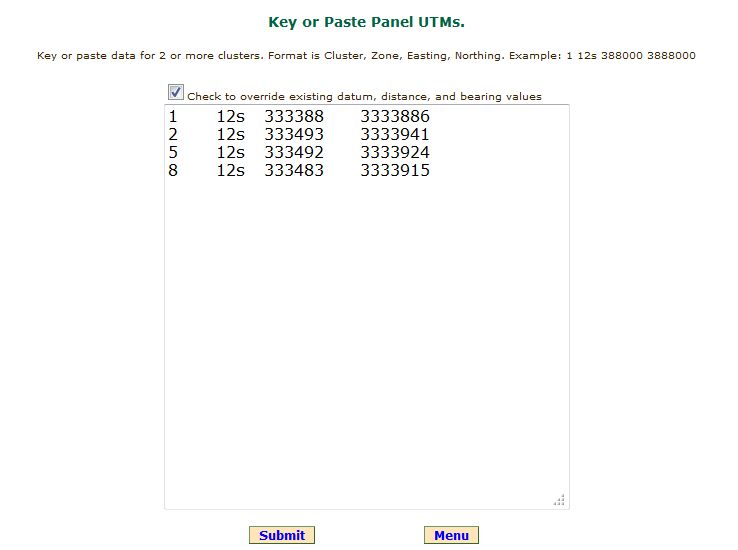
The second page includes a text area where the cluster UTM data may be keyed or pasted. If the data is keyed directly, add 1 or more spaces between the fields. If existing data for any of the cluster numbers is to be overwritten, check the override box. This checkbox is a safeguard to insure data keyed in Categorize Images is not accidently overwritten. Click the Submit button.
 |
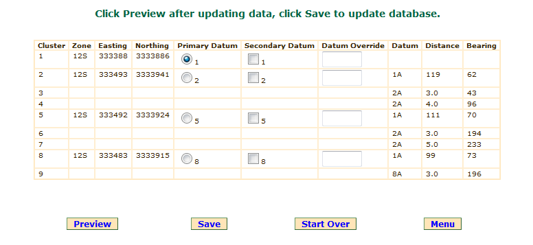
The next page includes a list of all cluster location data for the survey, a google satellite view, and a topo chart. As shown below, the first cluster pasted into the above text area will be the primary datum by default and no secondary datums will be selected.
In the example below, distance and bearing measurements for clusters 3, 4, 6, 7, and 9 were made in the field and the data has already been entered through the Categorize Images transaction.
 |
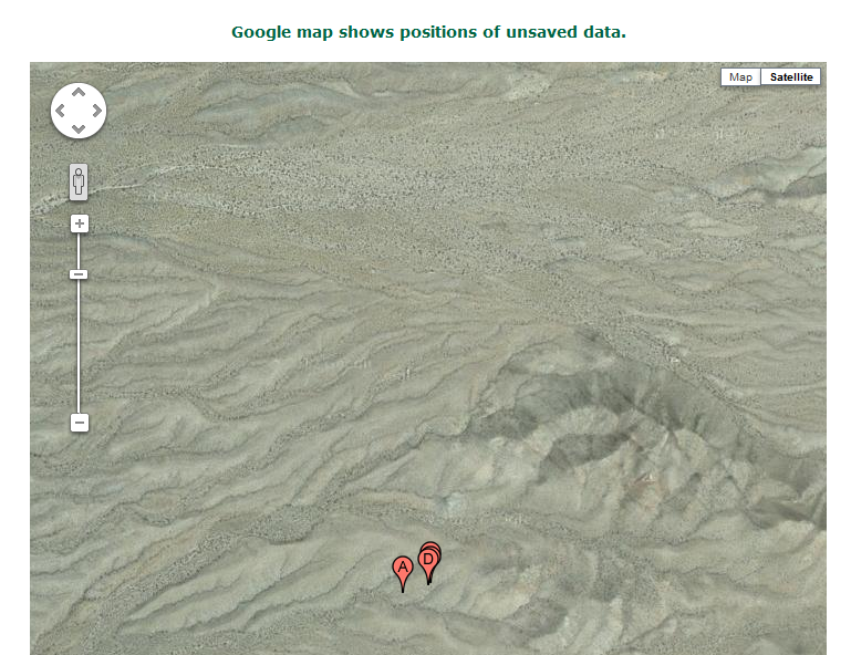
A google satellite view is provided as a convenience. This may be helpful in detecting obvious keying or recording errors.
 |
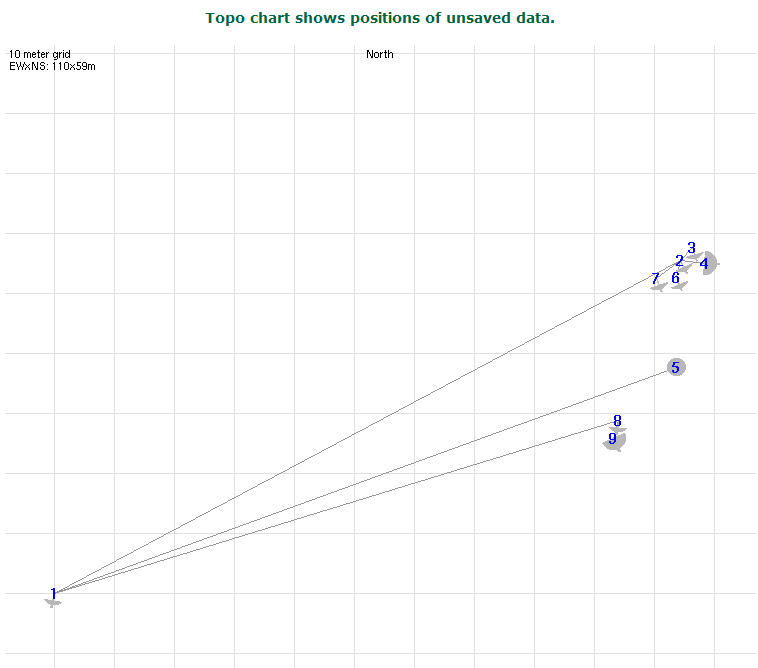
The topo chart shows the distance-bearing measurements. Looking at the example below, it appears cluster 5 would make a good secondary datum.
 |
After scrolling back to the top of the page, Cluster 5 is made a secondary datum by checking its Secondary Datum checkbox and clicking the Preview button. See below.
By default cluster 5 will become the datum for clusters 2 and 8 because both are closer to cluster 5 than to cluster 1. An alternative to checking the cluster 5 Secondary Datum checkbox would have been to enter "5" into the Datum Override text fields for clusters 2 and 8. Another alternative could have been to check the radio button making cluster 5 the primary datum.
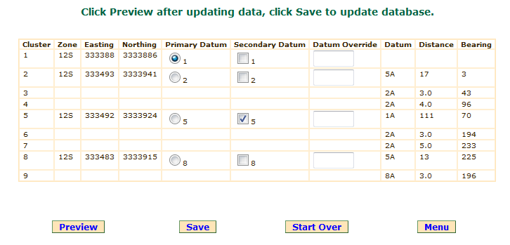 |
As shown below, the updated topo chart shows cluster 5 as the datum for clusters 2 and 8. Later, the Customize Topo Charts transaction may be used to refine the topo chart by shrinking the bearing line between clusters 1 and 5.
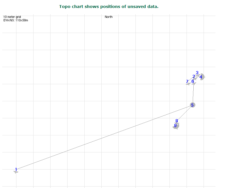 |
For larger surveys, it may take several iterations to achieve the desired result. Be sure to click the Save button to save the data.
Buttons
Preview: recalculates and displays the data table, google satellite view, and topo chart.
Save: saves the data and displays the main menu.
Start Over: redisplays the page with the text area for entering UTM data.
Menu: takes you to the Main menu.
 DigitalRockArt Wiki